Research project
Title: Data Assimilation Schemes in Colombian Geodynamics - Cooperative Research Plan for 2017 - 2020 Between Universidad EAFIT and TUDelft, With the Help of universidad de antioquia and universidad nacional de colombia sede medellin
O. L. Quintero M, Dept. of Mathematical Sciences, Research Group in Mathematical Modelling Universidad EAFIT, Colombia
A. W. Heemink, Dept. of Applied Mathematics, Delft University of Technology, mekelweg 4, 2628 CD Delft, The Netherlands
N. Pinel, Dept. of Biological Sciences, Research Group on Biodiversity, Evolution and Conservation (BEC) at Universidad EAFIT, Colombia
A J. Segers, TNO, Dept. of Climate, Air and Sustainability, P.O Box 80015, 3508 TA Utrecht, The Netherlands
M. Verlaan, Senior Specialist Deltares, Rotterdamseweg 185, 2629 HD Delft The Netherlands
Andrés Yarce - Universidad EAFIT
Santiago López - Universidad EAFIT
by Martín Rodríguez - Universidad EAFIT
If using material from this cite, please give us some credit!
New domains for future work by Nicolas Pinel
Mission Helicopter In situ Pollution Acquisition Experiment (H.I.P.A.E)
The scientific initiative MAUI Medellin Air qUality Initiative that brings together several projects of scientific research and technological development, from several research groups of the Universities EAFIT and Universidad de Antioquia and their national and international strategic allies.
Our purpose is to develop high-level scientific research that allows not only the decision making based on science but also solutions for the problems of environment and sustainability because of air pollution in human health, agriculture, and ecosystems.
In the Mission called Helicopter In situ Pollution Acquisition Experiment (H.I.P.A.E), we developed a proof of a concept inside the aircraft FAC4121 with the support not only of the GRUCO but also of the CETAD and the dedication of the crew on board.
 MAUI.General.20190928.pdf
 Presentation TNO Tropomi.pptx
Description
The Data Assimilation project seeks to strengthen the relationship between Universidad EAFIT (Colombia) and TU-DELFT University (the Netherlands), with the support of TNO and Deltares (the Netherlands), through the training of doctorate students in Mathematical Engineering. This project counts with satelite databases which provide information of meteorological and environmental variables in a region that includes parts of South, Center and Nort America. Currently a preliminar processing of available data is being performed such that a better understanding of the temporal and spatial evolution of the variables of interest (such as the emission of harmful substances) can be achieved. In the future, the project has the objective of developing new data assimiliation schemes over LOTOS-EUROS model, to be able to predict the evolution of the variables at a greater resolution, in order to aid environmental protection and provide new knowledge in applied mathemathics.
Now we have a dynamic of collaboration with Prof. Angela Rendón - Universidad de Antioquia with WRF Model and Prof. Carlos Hoyos with SIATA, recognized experts in Meteorology. We are commited to develop a strong relationship regarding the scientific, technical and practical issues on the field by building a research network.
Research Interests
Mathematical - Modeling
The Colombian air quality dynamics analysis will be develop through the use of the LOTOS-EUROS Model from TNO looking for the cooperation between Universities and Institutions.
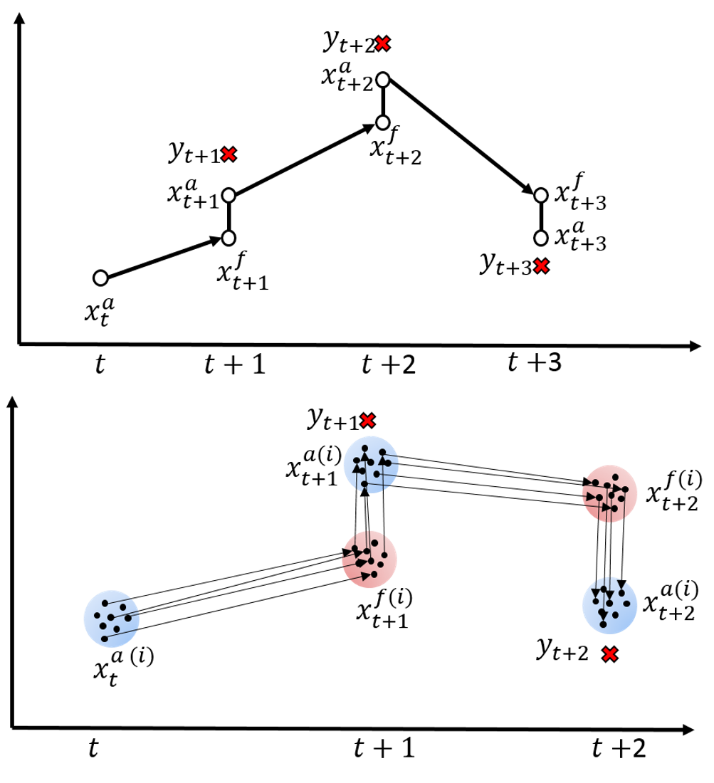
Seeking for the improvement and development of new Data Assimilation Schemes from Mathematical point of view for two applications regarding the GeoSciences, Geophysics and Environmental issues. We propose at least seven theoretical aspects related to the Data Assimilation Schemes regarding the Backtracking localization strategies for Ensemble Kalman Filter and the traj4D-Var proposed by (Fu et al, 2015 and Lu et al, 2015), also the application of Observational impact analysis algorithm (TSBOI-MM) (Verlaan and Sumihar, 2016) in order to establish a research plan for new PhD students that will be able to follow a co-supervised Doctoral formation between TU Delft Applied Mathematics PhD programme and Universidad EAFIT Mathematical Engineering PhD Programme.
In cooperation with Universidad de Antioquia we propose the evaluation of models WRF/OPEN LOTOS-EUROS on the characterization of daily cycle for meteorology and pollutants dispersion in Valle de Aburrá (Aburrá Valley) also the study of Scenary for the Aburrá Valley and its environmental implications through WRF/OPEN LOTOS-EUROS. Coupling and static/dynamic downscaling of the models are challenging task depending on models and data availability.
Prof. Angela Rendón - Universidad de Antioquia
Andrés Posada - Universidad de Antioquia
Jhon Edinson Hinestroza - Universidad EAFIT
Measurement of Data Impact in models and Data Analysis
Check out our media of the data we have on the bottom of this site!
Ecological –Health
Accompanying our interest on data assimilation, and on integrating LE and WRF, are a set of ecosystem and human health related objectives.
We have developed an interest on the regional transport of marine aerosols. This focus is less related to air quality and more to an ecological and evolutionary question. Some of the work of our Research Group on Biodiversity, Evolution and Conservation (BEC) takes place in the forests of the Darién, one of the biodiversity foci in the country. (This is in the Choco Region, in the Northwest corner of the country bordering Panama). We have heard comments from people in the region that during certain times of the year, the salty spray reaches three to four kilometers inland. It intrigues us to understand this distribution of marine aerosols, to see if there are changes in plant community structures associated with this exposure.
All of the research interests on nitrogenous species, ozone and marine aerosols face the challenge of the scarcity of in situ measurements. We are looking into ways of increasing the availability of sensors in the regions of interest. In the meantime, it will be of paramount importance to maximize the use we can make of satellite data.
Events
Air quality and its impact on human health, agriculture and natural ecosystems: a mathematical modelling perspective
Methodology
Here the methodological aspects regarding the agreement between both PhD programmes and also, the methodological strategies for the fullfillment of the objectives. A research plan for two Master Students in Applied Mathematics is adressed in this section. Take into account that the Doctoral formation of two PhD students will be complemented through their participation in the research project and of course will contribute to the proper fullfillment of the objectives but in any case they will be responsibles for the succes in the fullfillment of all the activities. Regarding the Undergraduate students, the same policy will apply but in this document their specific plans are also specified.
Phase 1 Year 2017
For the proper fullfilment of the research activities a 1 month visitor professor activities will be necessary. This visit will be performed between the months of late May and Jun 2017, regarding both Universities academic activities calendar.
Data Assimilation schemes appropiation
Evaluation of the feasibility of application of LOTOS-EUROS Model to the recent environmental crisis in Medellin Colombia.
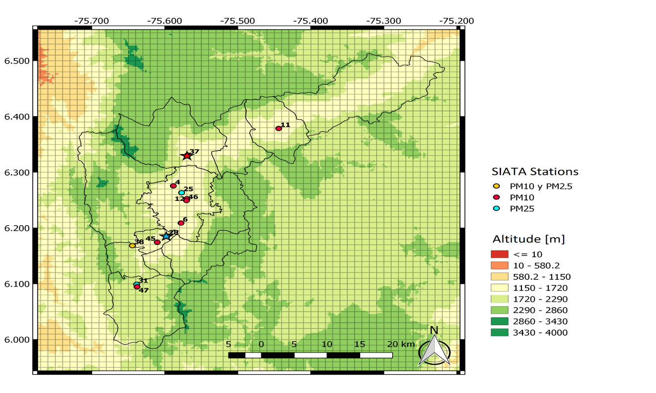
Analysis of the measurements retrieved from Sistema de Alerta Temprana del Valle de Aburra SIATA.
To develop an analysis a of the dynamics underlying the atmospheric behavior in Metropolitana Area
To develop an evaluation of results regarding the ecological impact and human health
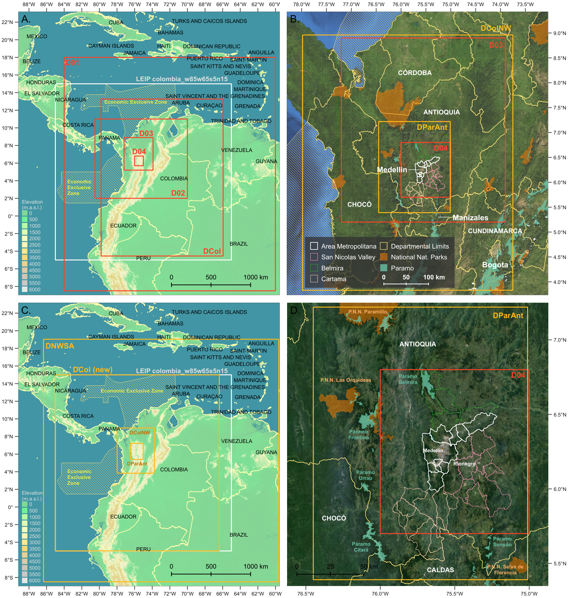
Set up of the LOTOS-EUROS in Colombia model in OpenLE and OpenDA.
Evaluation of the measurements regarding the posibility to use them in a Ensemble Kalman Filter scheme with variance localization.
Evaluation and Comparison of the Data Assimilation traditional techniques over LOTOS-EUROS in Colombia.
Application of the traditional localization strategy for Data Assimilation on LOTOS-EUROS in Colombia for Medellin air quality.
Verification of the feasibility for the development of an extension for the trj-4DVar (Lu et al, 2015) in LOTOS-EUROS Volcanic ash problem to bigger systems and mathematically feasible solutions to solve the mod- ified cost function in a new or improved approach adjoint free. We find feasible to try a hybrid scheme for the ill conditioned problem in order to deal with reduced observational noise.
Testing the backtracking strategy for the Ensemble Assimilation scheme developed (Fu et a, 2015) in LOTOS-EUROS Volcanic ash problem against the developed by Liu and Xue (2016) and its approximate ensemble covariance localization.
To merge both “spurious” approaches for “multiple observations” prob- lems (variable localization)in LOTOS-EUROS Volcanic ash problem.
Publication of preliminar research results.
Phase 2 Year 2018
For the proper fullfilment of the research activities a 1 month visitor professor activities will be necessary. This visit will be performed between the months of late May and Jun 2018, regarding both Universities academic activities calendar.
Increasing the resolution of the model for the area of El valle de Aburra, because of the grid of LOTOS-EUROS is aprox 7km x7km,
Evaluation of the scientific literature regarding the plume model for high resolution models.
Evaluation of the feasibility for the application of trj-4DVar (Lu et al, 2015) for Data Assimilation Schemes in Colombia Air Quality model with LOTOS-EUROS.
Verification of the feasibility for the development of an extension for the trj-4DVar (Lu et al, 2015) to bigger systems and mathematically feasible solutions to solve the modified cost function in a new or improved approach adjoint free. We find feasible to try a hybrid scheme for the ill conditioned problem in order to deal with reduced observational noise in Colombia Air Quality model with LOTOS-EUROS.
Evaluation of the backtracking strategy for the Ensemble Assimilation scheme developed (Fu et a, 2015) against the developed by Liu and Xue (2016) and its approximate ensemble covariance localization for Data As- similation Schemes in Colombia Air Quality model with LOTOS- EUROS.
Evaluation of the use of a formal sensitivity analysis for the perturbation of the inputs to the two experience based modifications in cost function in the trj-4DVar (Lu et al, 2016 under review), specifically in the penalty term in order to develop a generalized method and probe the stability of the solution in LOTOS-EUROS Volcanic ash problem.
Building the evidence and formalization of the postulate for accuracy in trj-4DVar for a physical-related window of assimilation, regarding the demonstrated accuracy in assimilation windows that does not compromise the constant concentration of particles in atmosphere (Lu et al, 2016 under review) in LOTOS-EUROS Volcanic ash problem. Our hypothesis is that dynamically it will change with winds profile.
To merge both "spurious" approaches for "multiple observations" problems (variable localization) in LOTOS-EUROS Volcanic ash problem.
Publication of preliminar research results.
Students thesis proposal defense.
Phase 3 Year 2019
For the proper fullfilment of the research activities a 2 month visitor professor activities will be necessary. This visit will be performed between the months of late May and July 2018, regarding both Universities academic activities calen- dar.
To analyze and/or quantify the impact of the proper selection of a data subset (from a big source of data) to be used in a Data Assimilation scheme in order to develop a weighting strategy or sensitivity analysis to use the environmental information in other systems. Based in previous work of observation sensitivity matrix (Krymskaya et al, 2010).
Continuation of Phase 2
Publication of preliminary research results
Evaluation of the feasibility for the development of a city-scale, pollution exposure risk model (Soares et al, 2014).
Phase 4 Year 2020
For the proper fullfilment of the research activities a 2 weeks visitor professor activities will be necessary. This visit will be performed in October 2020.
Formalization of preliminar results of Phase 1, 2 and 3.
Publication of research results.
Students thesis defense.
Data sources provided by TNO for research purposes
COPERNICUS PROJECT
LEIP
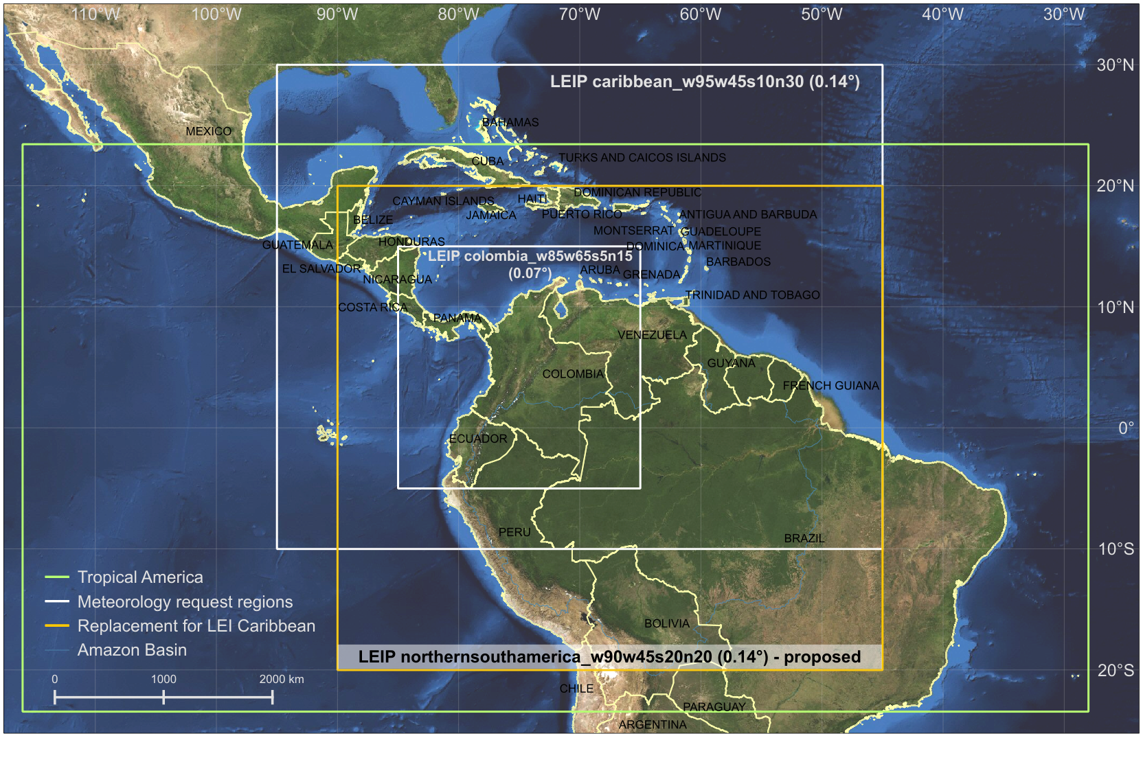
This database contains information from two satelites ECMWF and MACC. Image Provided by
Henk, Eskes from KNMI - TNO from TROPOMI instruments
ECMWF
This satelite provides data about topological and meteorological variables:
Variables defined only in 2-Dimensional space.
- Land Sea Mask.
- Surface Altitude.
- Soil Type.
Variables defined in 2-Dimensional space and time.
Boundary Layer Height.
Sea Ice Cover.
Convective precipitation.
2 Metre Dewpoint temperature.
Large sale precipitation.
Snow depth.
Snowfall.
Surface solar radiation downward.
Sea surface temperature.
Volumetric soil water layer (1 – 4).
2 Metre Temperature.
Total Cloud cover.
10 Metre U wind component.
10 Metre V wind component.
Variables defined in 3-Dimensional space and time.
The 2-Dimensional space is discretized in the following manner:
| |
# Points | Min (degrees) | Max (degrees) | Resolution (degrees) |
|
Latitude | 322 | -15.113 | 30.0117 | 0.1406 |
|
Longitude | 181 | 274.781 | 300.094 | 0.1406 |
Time measurements are provided with a 3 hour sample period, starting from March 31st 2015 until April 4th 2016.
The altitude component is given using a Hybrid Sigma-Pressure coordinate system. The coordinates are defined in layers, which are given in units of pressure (Pa). More information about this coordinate system can be found in:
The coordinate system is defined by two scaling coeficients and surface pressure:
P(n,k,i,j) = a(k) + b(k) * ps(n,i,j)
Where P is the pressure at time n, layer k, and 2D position (i,j). a(k) (units: Pa) and b(k)(unitless) are the sigma-pressure coeficients dependent only of the layer k, and ps(i,j) (units: Pa) is the surface pressure that depends on the 2D position.
The data given by ECMWF is divided in 20 layers, and information about a and b is given for layer interfaces (21 points) and layer midpoints (20 points).
The following figure shows the behaviour of the a and b coefficients:
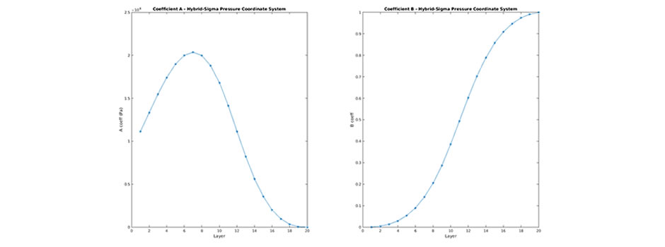
It can be seen that higher layers have a b coefficient close to 1, and an a coefficient close to 0, so the pressure coordinate is follows the surface pressure. In contrast, lower layers have a b coeffcients close to 0, so the pressure coordinate is a constant pressure for the 2D space given by an a coefficient offset.
The following figure shows the resulting pressure coordinate system for the 2D position of Medellin at an arbitrary moment of time:
MACC
This database provides information about the emission and flow of substances.
Wildfire database
For the case of wildfires, the flux of the following substances is provided:
- Carbon Dioxide
- Carbon Monoxide
- Methane
- Non-Methane Hydro-Carbons
- Hydrogen
- Nitrogen Oxides Nox
- Nitrous Oxide
- Particulate Matter Pm2.5
- Total Particulate Matter
- Total Carbon In Aerosols
- Organic Carbon
- Black Carbon
- Black Carbon
- Sulfur Dioxide
- Methanol
- Ethanol
- Propane
- Ethene
- Propene
- Isoprene
- Terpenes
- Toluene_Lump
- Higher Alkenes
- Higher Alkanes
- Formaldehyde
- Acetaldehyde
- Acetone
- Ammonia
- Dimethyl Sulfide
- Ethane
- Toluene
- Benzene
- Xylene
- Butenes
- Pentenes
- Hexene
- Octene
- Butanes
- Pentanes
- Hexanes
- Heptane
Other variables provided:
- Mean Altitude of Maximum Injection.
- Experimental Products.
- Altitude of Plume Top.
This data is given for specific locations associated with wildfires, which are located in a 2D space grid with the following resolution:
| |
# Points | Min (degrees) | Max (degrees) | Resolution (degrees) |
|
Latitude450 | 450 | -15.95 | 29.95 | 0.1 |
|
Longitude | 250 | 275.05 | 299.95 | 0.1 |
The measurements are given daily from March 31st 2015 to April 4th 2016.
Substance emission
Data is provided for the emission and flux of the following substance:
GEMS Ozone.
Nitrogen Dioxide.
Sulphur Dioxide.
Carbon Monoxide.
Formaldehyde.
Sea Salt Aerosol Mixing Ratio (0.03-0.5, 0.5-5, 5-20 um).
Dust Aerosol Mixing Ratio (0.03-0.5, 0.5-5, 5-20 um).
Hydrophobic Organic Matter Aerosol Mixing Ratio.
Hydrophilic Organic Matter Aerosol Mixing Ratio.
Hydrophobic Black Carbon Aerosol Mixing Ratio.
Hydrophilic Black Carbon Aerosol Mixing Ratio.
Sulphate Aerosol Mixing Ratio.
Aerosol type 12 mixing ratio.
Aerosol large mode mixing ratio.
Each variable is given in a 3D space grid and in time. The sample period is 3 hours from March 31st 2015 to April 4th 2016.
The 2D space is discretized in the following manner:
| |
# Points | Min (degrees) | Max (degrees) | Resolution (degrees) |
|
Latitude450 | 66 | -15.0877 | 30.5263 | 0.7031 |
|
Longitude38 | 38 | 274.2188 | 300.2344 | 0.7031 |
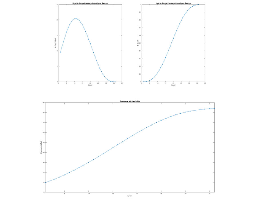
For the height dimension, the hybrid sigma-pressure coordinate system is used. This variables use 36 layers, with information given for layer interfases and midpoints. Figures for the a and b coefficients and the resulting pressure at Medellin are given below:
Media (by Martín Rodríguez)

Emission of substances (Ozone) in 2D and altitude views.
Frequency analysis of substance emission (Sulphur dioxide) at Medellin’s location.
Lotos-Euros
This database contains information about human caused substance emissions and paremeters required for running the OPEN LOTOS-EUROS model.
Radiation
Contains information of the optical caracterization of aerosols and clouds.
Emissions
Information is provided about the emission of the following substances due to anthropogenic sources:
-
NOx.
-
SOx.
-
NMVOC (Non-Methane Volatile Organic Compounds).
-
CH4.
-
NH3.
-
CO.
-
PM 2.5,10 (Particulate Matter).
For each of the substances, different source catetgories are distinguished:
- Power Generation
- Small combustion sources
- Industrial combustion
- Industrial processes
- Extraction and distribution of fossil fuels
- Solvent use
- Road transport
- Other mobile sources
- Waste treatment and disposal
- Agriculture
In addition, input parameters for the LOTOS-EUROS model for each substance is included. This parameters are production factors that depend of the region (country), vertical distribution of the substances, time (e.g. month, day of the week, hour of the day), and temperature.
Dust flux
Information about dust flux properties (friction velocity) are given according to the soil texture class. This is needed as an input parameter for the LOTOS-EUROS model.
Landuse
This database describes the type of land that covers the surface. It is required for the LOTOS-EUROS model to determine flux velocities, surface interactions and emission of organic substances. The different landuse categories are:
- Tree cover.
- Burnt vegetation.
- Shrub cover.
- Herbaceous cover.
- Sparse herbaceous.
- Regularly flooded herbaceous cover.
- Cultivated and managed areas.
- Bare areas.
- Water bodies.
- Snow and ice.
- Artificial surfaces.
Data assimilation schemes in Colombian geodynamics - cooperative research plan for 2017 - 2020 between Universidad EAFIT and TUDelft,
help of Universidad de Antioquia and Universidad Nacional de Colombia, sede Medellin
Technical Report – Methodology for the analysis of satellite based data. Medellín Air qUality Initiative MAUI
- Procedure Report - Copernicus Project 3D Satellite Data Analysis. Medellin Air qUality Initiative MAUI
 MAUI_RP-01.pdf
Procedure Report - Copernicus Project 2D Satellite Data Analysis. Medellin Air qUality Initiative MAUI
Technical Report – Implementation feasibility of LOTOS-EUROS model in Colombia Domain -Medellin Air qUality Initiative MAUI
Study of the impact of satellite and ground based data assimilated in meteorological and chemical transport models over natural areas of Colombia . Medellin Air qUality Initiative MAUI
Technical Report – Data Assimilation On Air Quality Models For Aburrá Valley. Medellin Air qUalityInitiative MAUI
Analysis of the data and infrastructure the early warning system of Medellin and Metropolitan Area SIATA
Medellin Air qUality Initiative MAUI
Procedure Report- Implementation Of Lotos-Euros In The Week Of The Contingency. Medellin Air qUality Initiative MAUI
Procedure Report- Implementation of LOTOS-EUROS between the days April 2015- March 1 2016 RP-05. Medellin Air qUality Initiative MAUI
Technical Report – Data Assimilation schemes, Theoretical aspects. Medellin Air qUality Initiative MAUI MAUI-RT-05
Sensitivity and uncertainty sources in numerical modeling to forecast atmospheric systems: High-resolution WRF model simulations in urban
valleys applied to air quality issues.
Cooperative Project: Universidad de Antioquia, Universidad EAFIT
Contributions of the Grupo de Ingeniería y Gestión Ambiental (GIGA), Escuela Ambiental, Facultad de Ingeniería, Universidad de Antioquia, Medellín, Colombia, Mathematical Modeling Research Group and Biodiversidad, Evolución y Conservación Research Group, Universidad EAFIT, DIAM at TUDELFT, TNO The Netherlands.
Angela María Rendón Pérez, Grupo de Ingeniería y Gestión Ambiental (GIGA), Escuela Ambiental, Facultad de Ingeniería, Universidad de Antioquia, Medellín, Colombia
Olga Lucia Quintero Montoya, Dept. of Mathematical Sciences, Research Group in Mathematical Modelling Universidad EAFIT, Colombia
PhD Student - Jhon Edinson Hinestroza
In cooperation with Universidad de Antioquia now we propose to study the uncertainty measurements and develop a framework for uncertainty reduction in a prediction step for Weather forecast via WRF Model, taking into account its NON real time computability and computational load.
We also propose the evaluation of both models WRF/OPEN LOTOS-EUROS on the characterization of daily cycle for meteorology and pollutants dispersion in Valle de Aburrá (Aburrá Valley) also the study of scenary for the Aburrá Valley and its environmental implications through WRF/OPEN LOTOS-EUROS. Coupling and static/dynamic downscaling of the models are challenging task depending on models and data availability. (Rendon et al, 2014; Posada et al, 2016)
oquinte1@eafit.edu.co
angela.rendon@udea.edu.co
News
If using material from this cite, please give us some credit!!!
We released out new character for Social knowledge activities: Hermilda
14TH INTERNATIONAL ENKF WORKSHOP IN VOSS JUNE 3-5, 2019 PARK HOTEL VOSSEVANGEN NORWAY
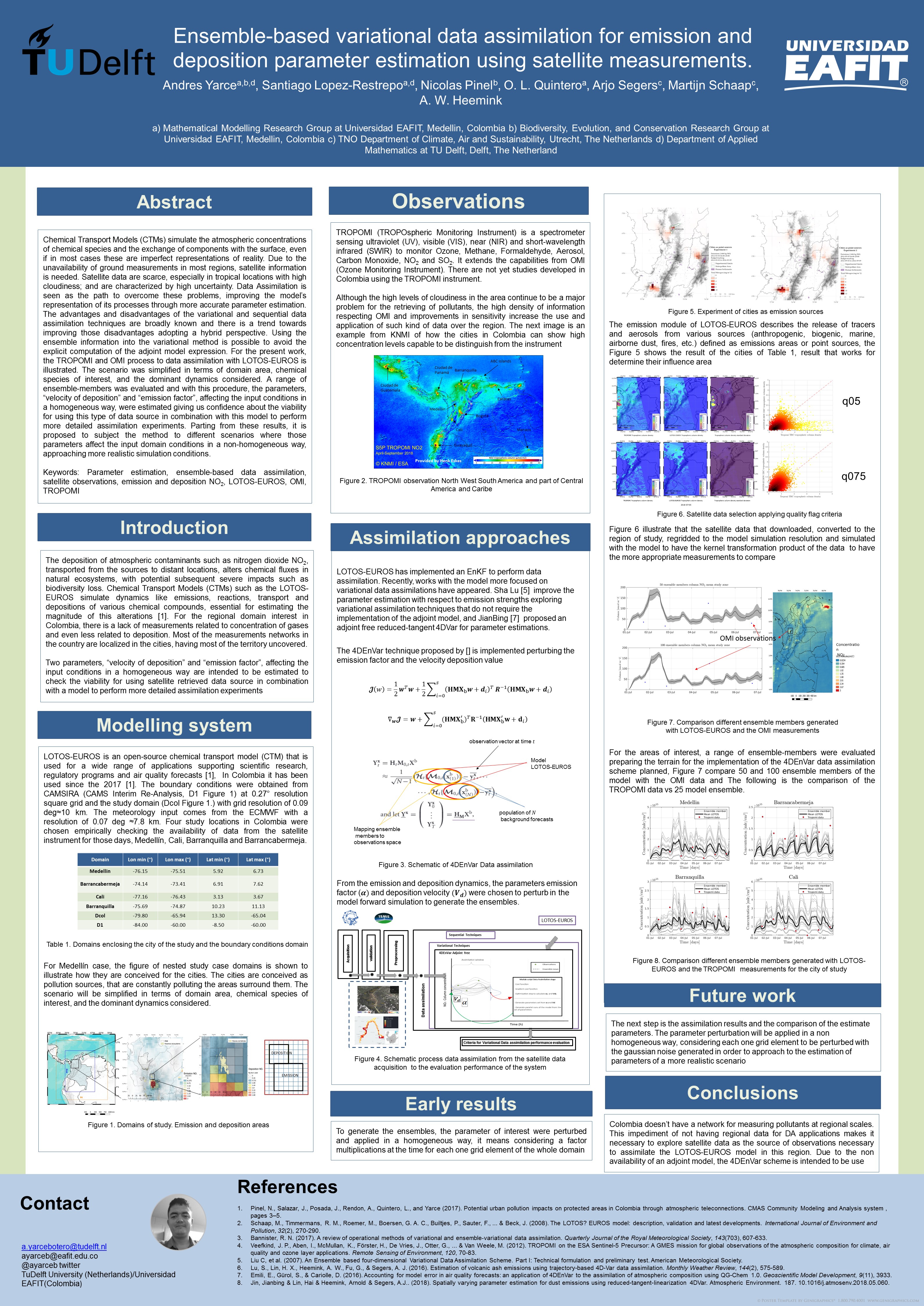
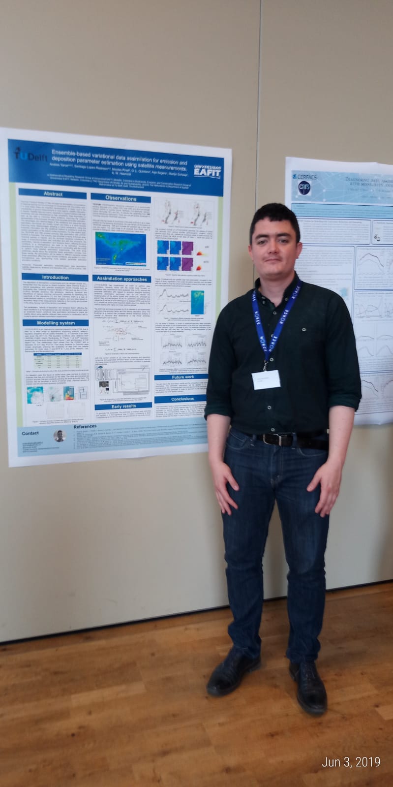
CMAS - 2019
H.I.P.A.E HELICOPTER-BORNE IN-SITU POLLUTION
ACQUISITION EXPERIMENT: ALTERNATIVE PLATFORM FOR MEASURING CONTAMINANTS IN
VERTICAL LAYERS
Elena Montilla5, Jose Ignacio Marulanda6, Camilo Isaza6, Mónica Lucia Álvarez Laínez7, Andrés Felipe Zapata7, Jaime Betancur8, Alejandro Duarte Acuña8, Jimmy Florez8, Juan David Agudelo Mejia8, Cristian David Quintero Muñoz8, Daniel Felipe Sacristan Avila8, Jose Fernando Duque9, Juanita Rausch1, David Jaramillo1, Angela Rendón2, Juan Sebastian Rodriguez11, Julian Gálvez3, Diego Valle4, Santiago López-Restrepo12, Andres Yarce Botero10,12, Nicolas Pinel10, O. L Quintero M12
GIGA2, FACOM3, Synthetic Biology and Biohacking Research Group4-Universidad de Antioquia, Applied Optics5 Applied Electromagnetism GEMA6 GRID Nanofibers group7, Environmental magnetism9, Biodiversity evolution and Conservation BEC10 Applied Mechanics11, GRIMMAT Mathematical Modeling group12-Universidad EAFIT
Particle Vision1, FAC CACOM-5 CETAD8
Abstract:
The scientific initiative MAUI (Medellin Air qUality Initiative) brings several research projects and technological development, with the purpose to develop high-level scientific research for the problems of environment and sustainability, impacts of air pollution in human health, agriculture, and ecosystems. In the mission called HIPAE (Helicopter In-situ Pollution Assessment Experiment), we developed a proof of a concept inside the aircraft from the Fuerza Aerea Colombiana (Colombian Air Force), where the metropolitan airspace of Aburrá Valley had been overflown with the purpose to obtain input data to be used for the design of a Lidar 4D system, and to complement the TROPOMI (TROPOspheric Monitoring Instrument) satellite measurements for the assimilation of data with the LOTOS -EUROS model at high and low resolution, increasing the impact from local to national in terms of the capacity to forecast the transport of pollutants. In the aircraft, two kinds of PM particle counters were on board as well two versions of the sensing platform named Simple for sensing meteorological variables (relative humidity, barometric pressure, temperature), altitude, geo-position and eight aerosol compounds (CO2, H2, NO2, NH3, C2H6OH, CH4, C4H10, C3H8). Additionally, one experiment to test filters developed with nanomaterials to trap pollutants in-situ that validate the hypotheses of nanomaterials to capture particulate material, offered valuable information on the composition, morphology, and chemistry via SEM-EDX (Scanning Electron Microscopy - Energy Dispersive X-ray spectroscopy) of the same material. From the data obtained it was possible to visualize high concentrations of aerosol compounds, especially compounds such as CO, NO2, and CH4, which shows the lowest concentration values in rural and forested areas compared with urban areas. The platform showed adequate behavior proving that the data delivered can be useful for modeling and monitoring the transport of pollutants.
Keywords: Helicopter-airborne, In-situ measurements, Air pollution, Chemical transport models, LOTOS-EUROS
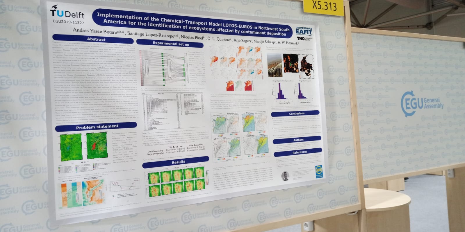
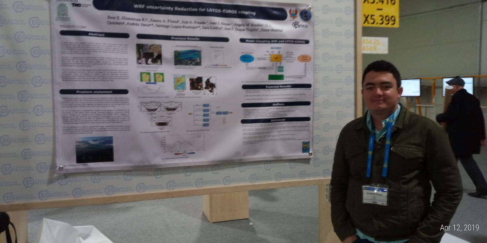
EGU - 2019
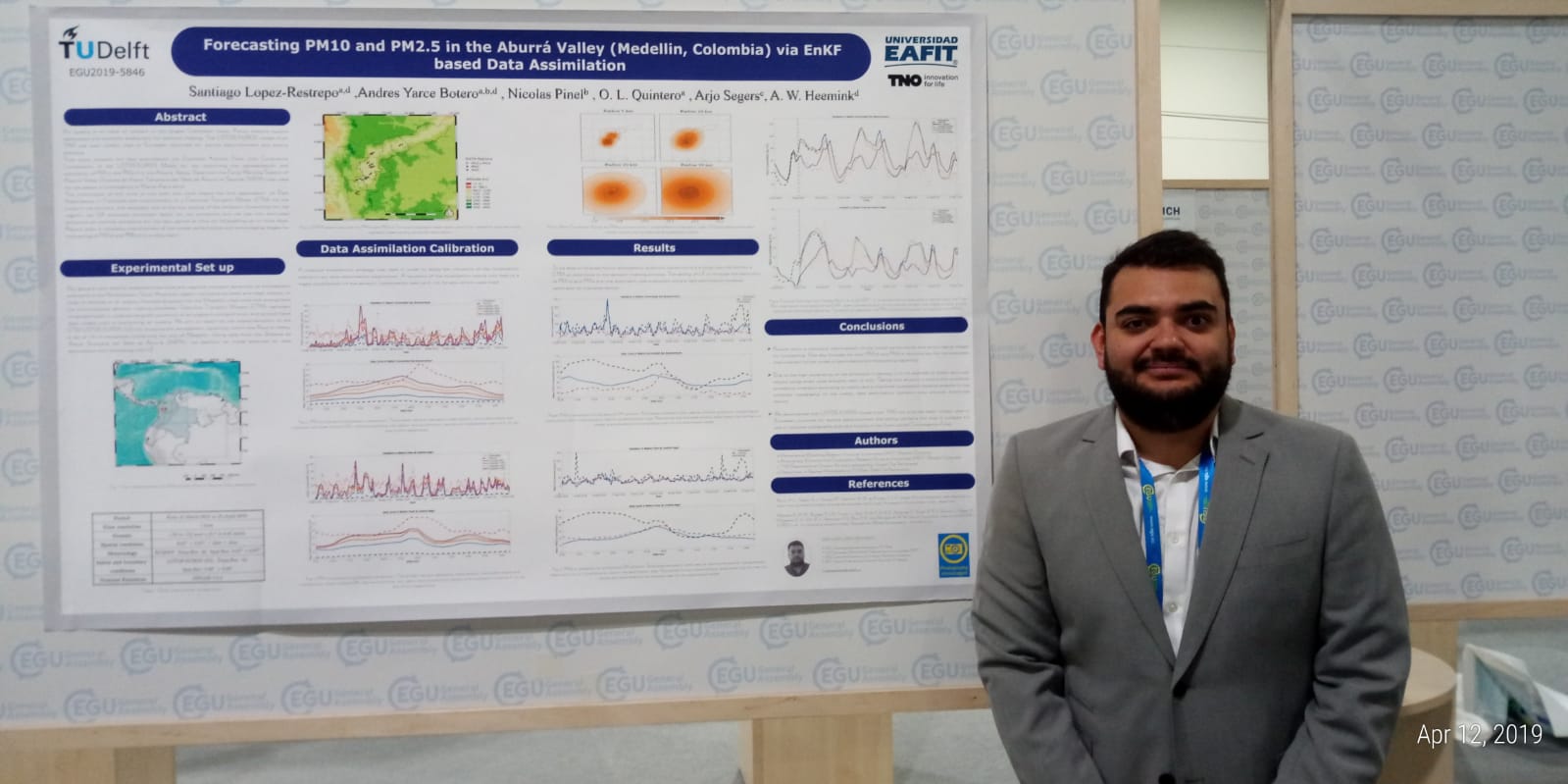
Santiago Lopez-Restrepo (1,2), Andres Yarce (1,2), Nicolas Pinel (3), Olga Lucia Quintero (2), Arjo Segers (4), and Arnold W Heemink (1). Lotos-Euros data assimilation for improving forecast of PM10 and PM2.5 in the Aburrá Valley. Geophysical Research Abstracts Vol. 21, EGU2019-5846, EGU General Assembly 2019
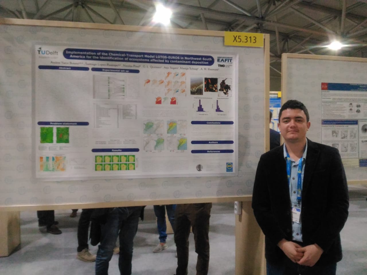
Andres Yarce Botero, Santiago Lopez-Restrepo, Nicolas Pinel, Olga Lucia Quintero, Arjo Segers, Martijn Schaap, and Arnold Heemink. Implementation of the Chemical-Transport Model LOTOS-EUROS in Northwest South America for the identification of ecosystems affected by contaminant deposition. Geophysical Research Abstracts Vol. 21, EGU2019-11327, EGU General Assembly 2019
Jhon Edinson Hinestroza, Jimmy Andreson Flórez, Jose Andrés Posada, Juan Jose Henao, Olga Lucia Quintero, and Angela María Rendón. WRF uncertainty Reduction for LOTOS-EUROS coupling. Geophysical Research Abstracts Vol. 21, EGU2019-11394-1, EGU General Assembly 2019
AGU - 2018
AGU Fall meeting 2018
WRF simulation of the Urban Heat island and its impact on wind Dynamics and Air Pollution Transport Mechanisms in a Densely Populated Urban Valley of Tropical Andes.
Angela M. Rendón1. José A. Posada‑Marín1 · Juan Jose Henao1. Juan F Salazar1. O. L Quintero3. Natalia Bernal1· John F. Mejía2
https://fallmeeting.agu.org/2018/program-overview/
CMAS - Conference Brazil Proceedings
 Program-Book-CMAS-SA-2017.pdf
Ciencia eafitense al servicio de la calidad del aire en Medellín
Un equipo interdisciplinario de investigadores busca aportar, desde la ciencia, nuevas perspectivas en el mejoramiento de la calidad del aire en el Valle de Aburrá.
More information.
Desde las matemáticas se busca mejorar la calidad del aire en el Valle de Aburrá
Medellín Air qUality Initiative (Maui), proyecto interdisciplinario e internacional liderado por la Universidad EAFIT, busca comprender el transporte atmosférico de contaminantes en el Valle de Aburrá.
More information.

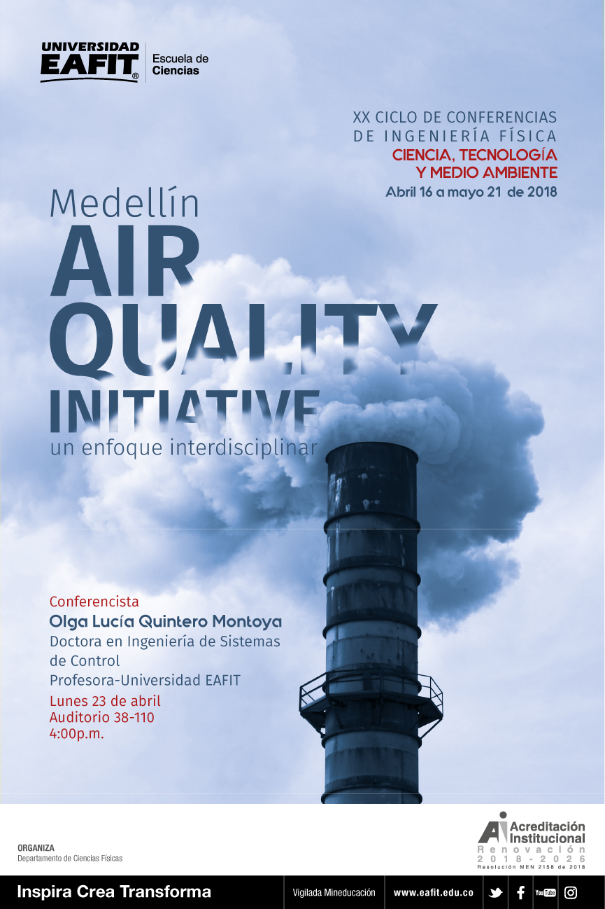
MAuI- Ciclo de Conferencias Ingeniería Física EAFIT
 MAuI_Ciclo_Ing_Fis_1.pdf
Marcopolo- Panda Project China
Pronostico de calidad de Aire